
Water management - especially the provision of high-quality drinking water - is dependent on functioning ecosystems in their catchment areas, which in turn benefit greatly from a high level of biodiversity. They play a decisive role in the self-purification capacity of soils and are therefore essential for clean raw water. In order to secure these and other ecosystem services (ES) in the long term in the context of climate change, sustainable and adapted environmental and operational management is required.
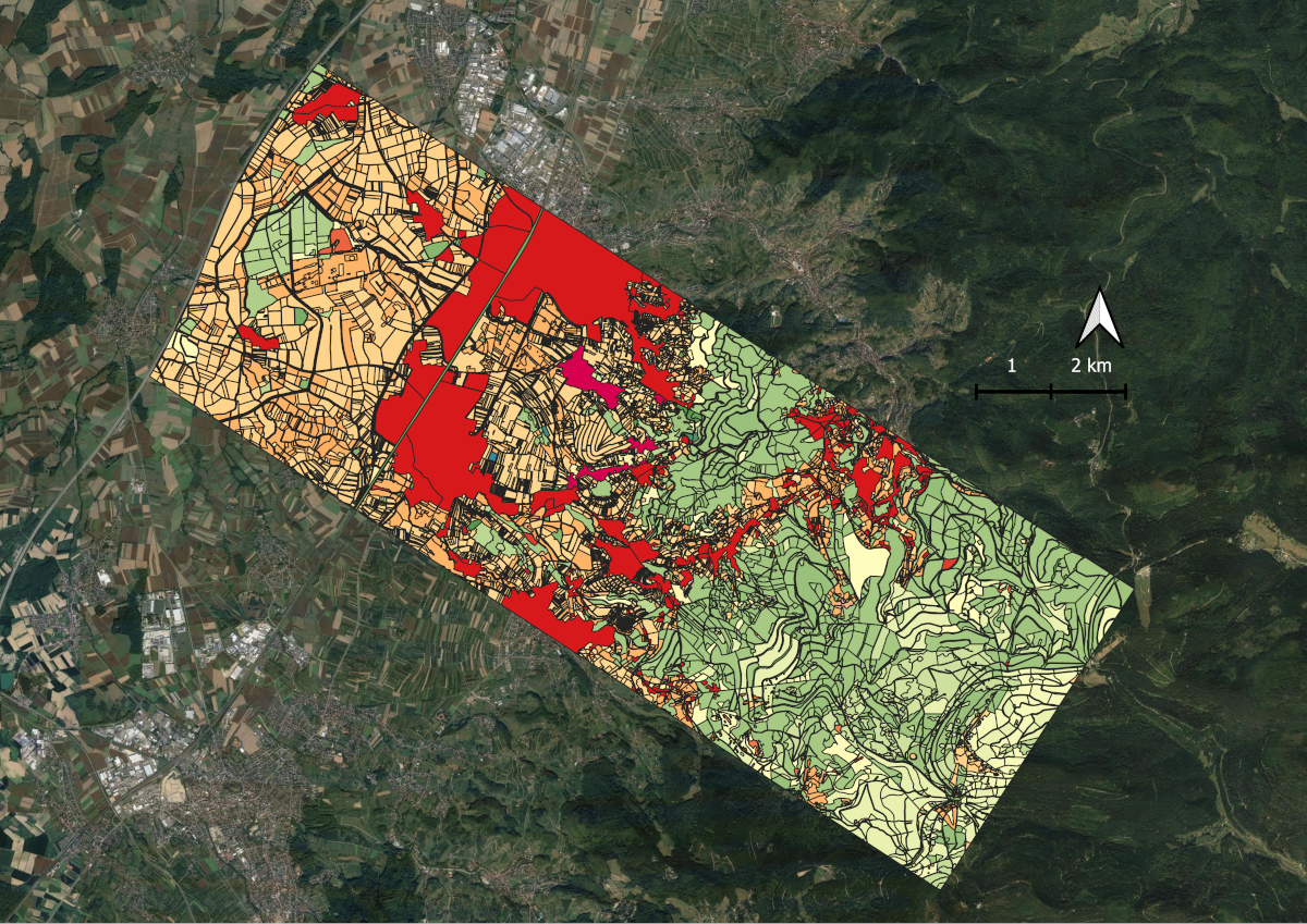
The BioWaWi research project is developing an integrative water balance and biodiversity monitoring system that supports water supply, climate adaptation and the conservation of biodiversity and ecosystem services in water protection areas. The project relies on participatory methods and a coordinated environmental management system for water suppliers. A key result of the project is the newly developed biotope type map for the study area in the Bühl region on the edge of the Black Forest (Baden-Württemberg). It serves as an important assessment basis for the ESS in the water protection areas and their surroundings. The mapped area covers around 62 km² with around 10,000 individual biotope type areas, including settlement structures, gardens, agricultural areas, meadows, moors and various tree and forest stands.
The mapping identified specific species and biotopes and assigned biotope codes. This forms the basis for a qualitative and monetary assessment of the ecosystem functions. For example, wetlands provide water purification and flood protection services, while meadows, in contrast to sealed or dried-out areas, contribute to groundwater recharge.
The biotope type map provides a valuable basis for planning and decision-making in order to develop targeted measures to protect and promote ecological conservation services and to easily record negative changes. It can also be used for modeling and scenario analysis to assess the impact of future land use changes and climate change on water supply and biodiversity.
The mapping was carried out as part of Carolin Reichert's doctoral thesis (KIT) and was significantly supported by NABU and five student theses. The high methodological effort over several months made it possible to identify potential for promoting biodiversity and biotope value and to derive concrete recommendations for action.